Sahalee Way Corridor Improvements
Next Steps
The Sahalee Way Corridor Study will share its next informational presentation to Council on December 2. City staff will report to City Council to answer their questions from the September 2 presentation which focused on additional ways to improve bicycle access while keeping costs manageable.
At that meeting, staff shared two new design options called Alternatives B.1 and C.1. These are updated versions of earlier concepts (Alternatives B and C) that were refined based on Council and community feedback.
Here are the materials linked below:
-
A map showing the updated alternatives: Alternatives Map
-
A Question & Answer document from the Council agenda
-
Public outreach summaries from the two community open houses: Open House #1 Open House #2
The next step for the Corridor Study is for City Council to select a preferred alternative that sets the level of improvements for pedestrians, bicyclists and transit riders. Once this is decided, staff will prepare a draft Sahalee Way Corridor Plan for review that provides a phased approach to improve the corridor over time.
Project Status to Date
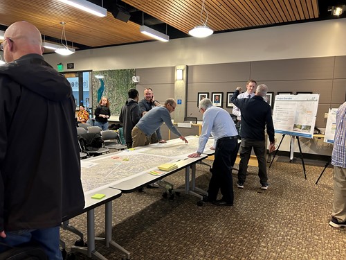
The City of Sammamish is committed to enhancing the Sahalee Way corridor to better serve all users, including pedestrians, bicyclists, transit riders, and drivers. In early 2024, we initiated a comprehensive outreach effort to gather community input on desired improvements for this vital roadway. Over 350 residents shared their ideas and concerns by participating at our April 24, 2024 open house and through an online survey.
Building on this feedback, we developed three alternatives that address both community preferences and technical requirements. This collaborative effort ensures that the proposed solutions are not only practical but also reflective of the community's vision for Sahalee Way. These alternatives shown below were shared with the public at a public Open House on April 24, 2025 and via an online survey. These alternatives and community feedback were also shared with Council at the June 10, 2025 Special Meeting.
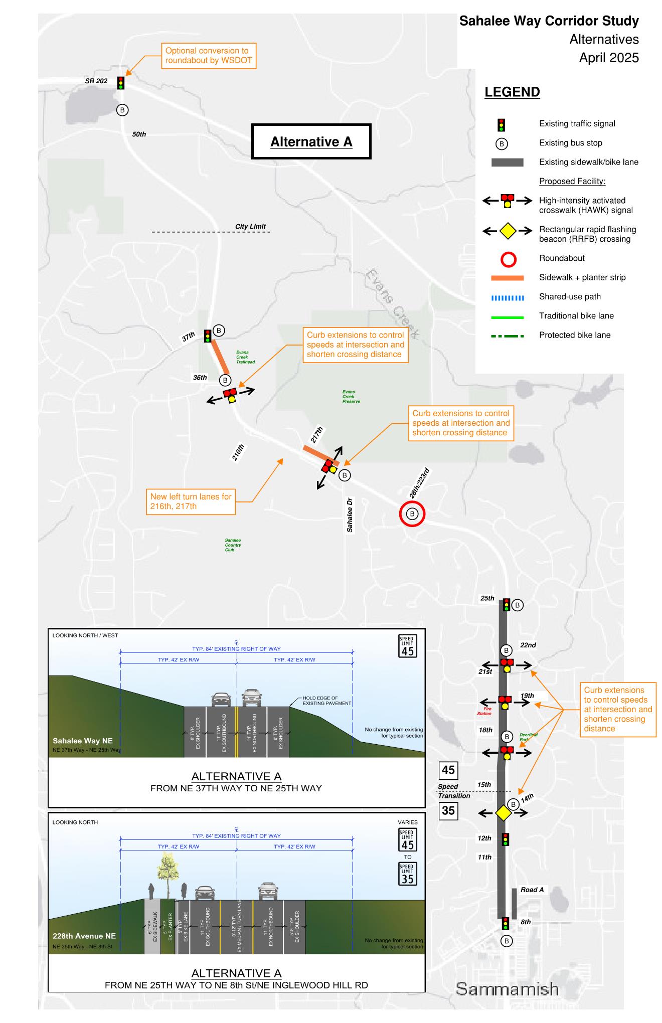
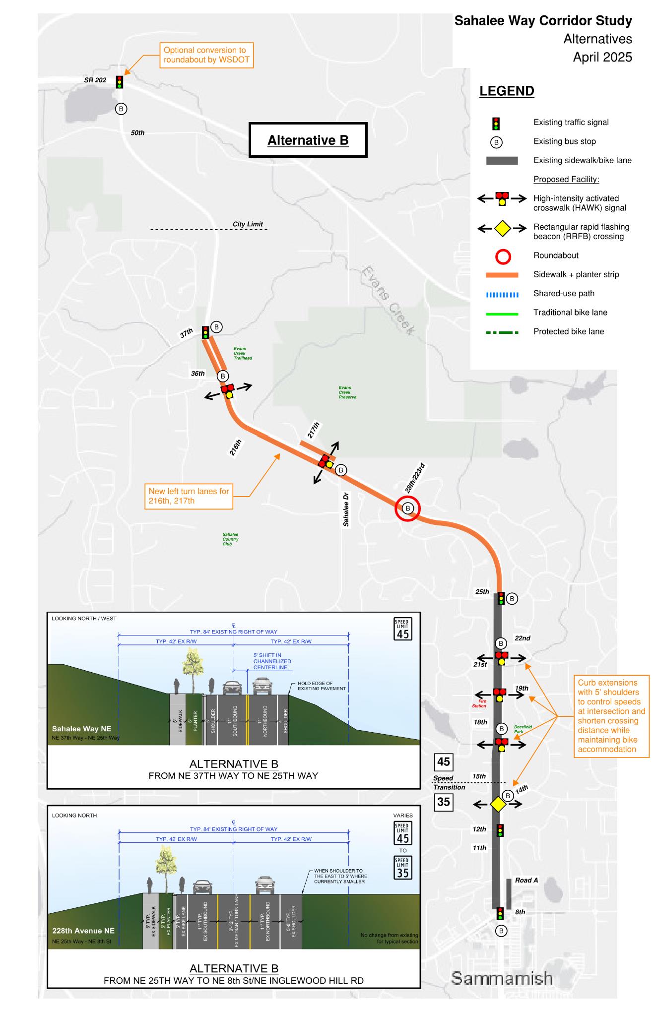
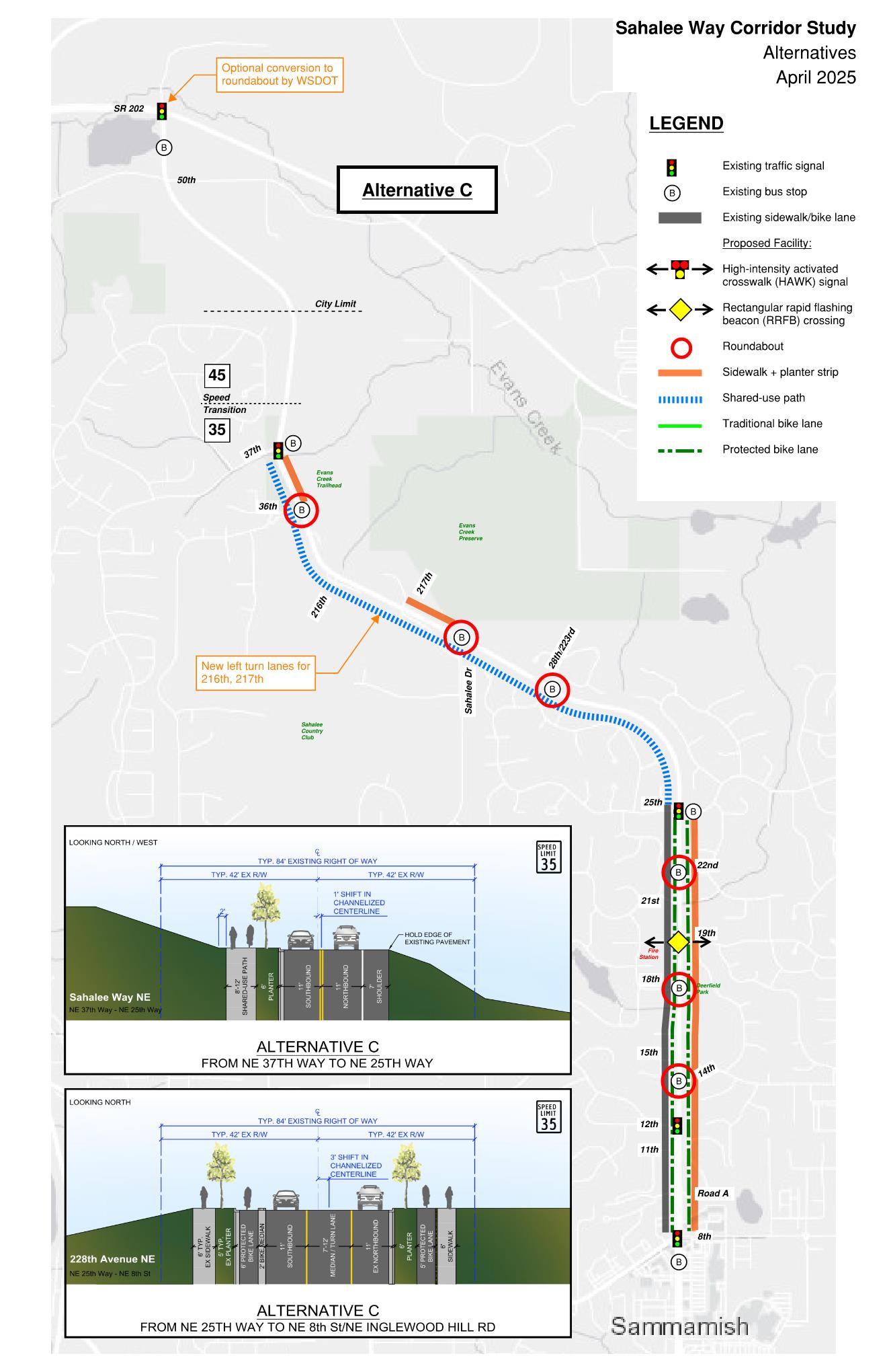
All alternatives end at NE 37th Way at the north end of the project area. No widening is needed north of NE 37th Way to SR 202 and significant slope stability challenges would make it cost prohibitive to do so.
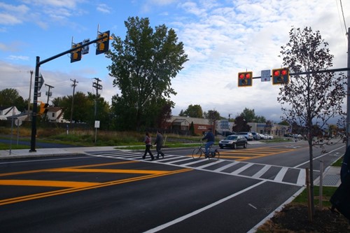
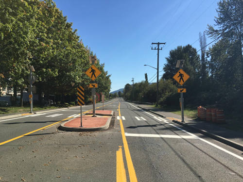
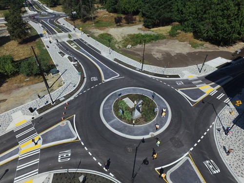
The images below provide examples of what some of the proposed improvements will look like.
Project Overview
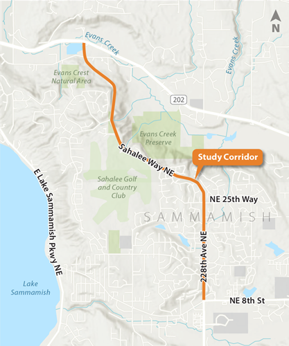
The City's ongoing Corridor Study is the process to develop a Corridor Plan that will serve as the master framework for future improvements on Sahalee Way. Staff has developed potential design alternatives to address non-motorized facilities and roadway improvements along 228th Avenue NE/Sahalee Way NE between NE 8th Street/NE Inglewood Hill Road and State Route (SR) 202.
Purpose and Need
- Purpose: To establish the near- and long-term vision for the 228th Avenue NE/Sahalee Way NE corridor that is beneficial, actionable, and supported by the Council and public.
- Need: Improve 228th Avenue NE/Sahalee Way NE to safely accommodate pedestrians, bicyclists, and transit users in Sammamish through changes to the intersections and corridor between NE 8th Street/NE Inglewood Hill Road and the north city limit.
Project Benefits
- Increased safety for bikes, transit riders, and pedestrians
- Roadway upgrades, potentially including paving improvements
- Improved connections to local trails/amenities, State Route 202, the Sammamish city center, and Redmond’s upcoming light rail transit service
- Promotes equitable transportation options for those without access to a personal vehicle
- Aligns with Sammamish's climate goals, which aim to close the non-motorized infrastructure gap between Sammamish and Redmond and reduce single-occupancy vehicle usage
Previous Public Involvement
Staff reported to Council at the Study Session on Tuesday, Feb. 11, 2025 at 6:30 PM. Copies of materials are shown below:
- Sahalee Council Study Session 2.11.2025 Slides
- Sahalee Council Study Session 2.11.2025 Handouts
- Sahalee Council Study Session 2.11.2025 Display Boards
- Sahalee Council Study Session 2.11.2025 Roll Plot
In early 2024, the public was asked for input on potential improvements they would like to see on the Sahalee Way Corridor.
We had a good turnout by the community at our public meeting held at City Hall on April 24, 2024 from 6-8 PM. Materials from that meeting are found below:
- Sahalee Presentation 04242024
- Sahalee Meeting Boards English 04242024
- Sahalee Meeting Boards Spanish 04242024