Fish Passage Barrier Assessment

Above: A photo of a fish barrier across a creek in the City of Sammamish (photo credit: Washington Department of Fish and Wildlife)
Project overview
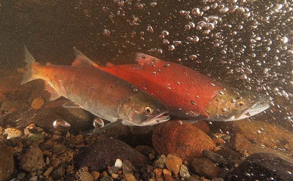
The City of Sammamish is home to over ten species of trout and salmon, including the kokanee salmon, which migrate from Lake Sammamish to streams and rivers that flow into the lake. Roads and other human-made structures have created barriers that stop fish – including salmon – from reaching the habitat they need to survive. Removing barrier culverts restores fish access to miles of stream habitat and can improve the productivity and biodiversity of our watersheds while reducing infrastructure maintenance expenses.
The City of Sammamish is partnering with the nonprofit Wild Fish Conservancy to identify and prioritize which fish barriers to replace within city limits, supporting long-term salmon recovery efforts. The assessment will guide smart, effective restoration strategies and projects based on real data.

Map of City of Sammamish: Major Rivers & Culverts indicated
Why we care
Salmon like the kokanee are a key part of the Pacific Northwest’s identity – but most salmon populations are a small fraction of what they once were, with many at risk of extinction. Many of the rivers and streams that drain to Lake Sammamish have instream features, such as culverts or drainage pipes, that make it difficult or impossible for salmon and other fish to pass upstream. When culverts or pipes are too small, steep, or blocked, they stop fish from swimming through.
Oftentimes, small, outdated culverts or drainage pipes are replaced with larger ones or bridges that allow water, fish, sediment, and debris to move more freely. Removing or replacing culverts opens up miles of stream habitat for fish and other aquatic species. It also helps restore shoreline vegetation by allowing movement of soil, rocks, and nutrients, improves ecosystems and biodiversity, helps manage surface water runoff, and reduces maintenance costs for old culverts.
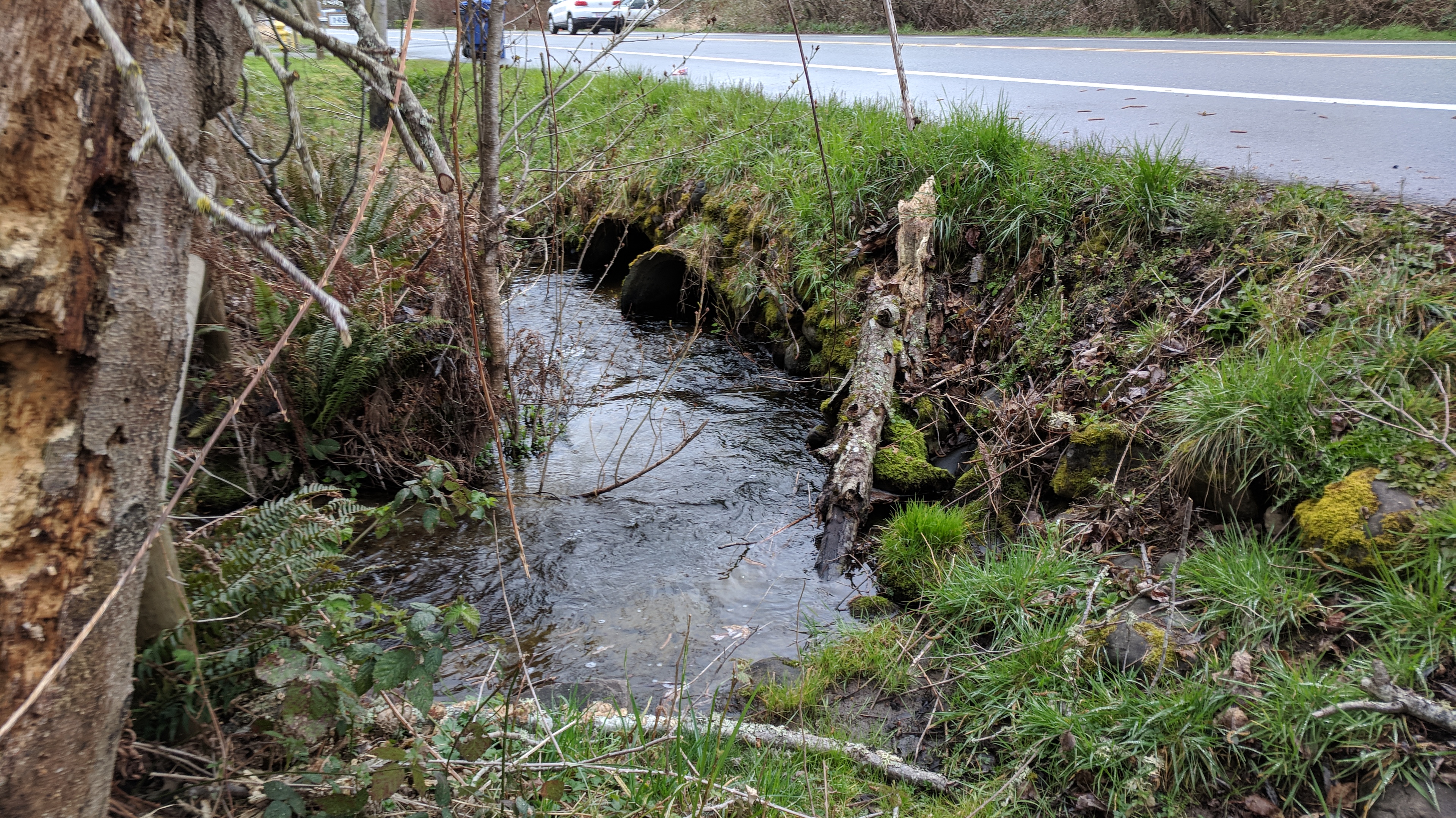
Above: A photo of the existing Ebright Creek fish barrier culvert at East Lake Sammamish Parkway in the City of Sammamish (photo credit: City of Sammamish)
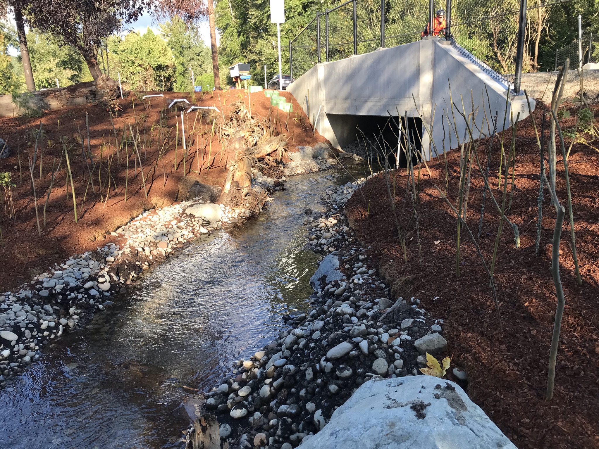
Above: A photo of the new Ebright Creek culvert at East Lake Sammamish Parkway in the City of Sammamish (photo credit: City of Sammamish)
The City of Sammamish's Stormwater Comprehensive Plan prioritizes sustainability and health as overarching goals. Part of reaching those goals is prioritizing existing fish passage barriers for repair and replacement.
Additionally, the Washington State Senate passed bill 2SHB 2251 requiring local governments to streamline permitting and identify and prioritize fish barrier removals.
City goals
City Stormwater Improvement Plan Goal G.1: Comprehensively evaluate and address problems related to the existing stormwater system and manage storm and surface water systems to ensure longevity of assets.
City Stormwater Improvement Plan Goal G.4: Protect the recovery of Lake Sammamish kokanee and other threatened salmonids.
What's the latest?
The City of Sammamish is partnering with Wild Fish Conservancy to inventory, assess, and prioritize which fish passage barriers the City should remove and/or replace first. The assessment will focus on finding barriers that will make the biggest impact for salmon and the ecosystem if removed or replaced. This fall, the City and Wild Fish Conservancy (‘project team’) will engage the community and gather feedback on proposed fish barrier assessment criteria.
How will the community be involved in the process?
The City of Sammamish is partnering with Wild Fish Conservancy to inventory, assess, and prioritize which fish passage barriers the City should remove and/or replace first. The assessment is in progress and has focused on finding barriers that will make the biggest impact for salmon and the ecosystem if removed or replaced. The criteria developed since last fall’s engagement has informed the assessments progress.
Criteria updates to the assessment process include the following categories:
- Habitat Quality
- Connectivity
- Aquatic Species
- Crossing Status
Each of these Criteria have several sub-criteria that will inform the total score for each category.
As the project progresses, the project team will engage with the public, stakeholder groups, community-based organizations, City departments, tribal groups, and environmental organizations through public events, meetings, social media notifications, and project website updates. We look forward to working with the community to complete this project.
This spring, look for project updates from the project team at regional events!
Project Interactive Map (New!)
Check out Wild Fish Conservancy's Interactive GIS Map. This map allows users to see what culverts have been assessed, how many, where, etc. This map also provides different functions available to the user to view the data differently. Each barrier will have a symbol representing the type of barrier it is (total, partial, unknown, etc) and the stream name (if available) the barrier is a part of. This map is updated as the project progresses.
Project Timeline
-
Completed: Fall 2025: The project team meets with the public and key stakeholders to gather input on the proposed fish barrier assessment criteria.
-
Completed: Winter 2025: Field work begins, and the project team assesses fish barriers.
-
In progress: Spring 2026: The project team meets with the public and key stakeholders to gather input on preliminary results, assessment criteria and process.
-
Summer 2026: The project team presents the final report, with recommendations on which fish barriers to prioritize for replacement, to the City of Sammamish.